Park Maps
Parks Trails Mobile App
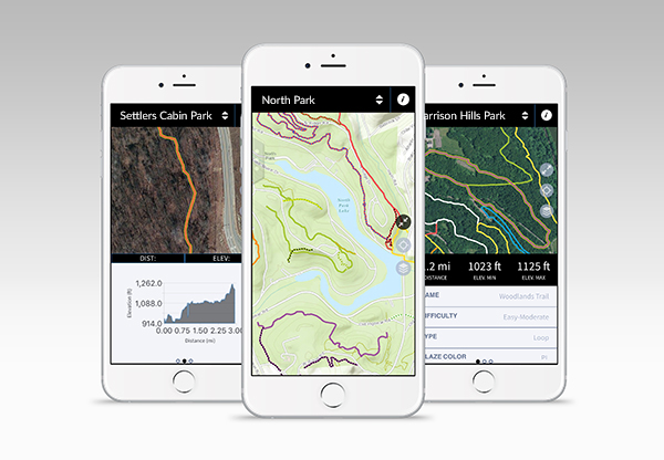
- Discover trails within each Allegheny County park and easily choose which one to traverse by viewing its length, difficulty, and elevation profile.
- Track your location using this GPS-enabled app, and switch among imagery, topographic or terrain basemaps to give you a better sense of your surroundings.
- Get current weather conditions, alerts, and upcoming forecasts from the National Weather Service (NWS).


Parks Trails Web Tool
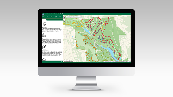
Use Parks Trails Web Tool
- Plan your trail route at any of the nine county parks.
- Zoom into an area of interest, draw or note anything in that area, and create custom PDFs that can be printed.
- Use in conjunction with the Allegheny County Parks Trail App for iOS and Android.
Park Shelters Map Tool
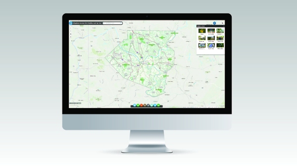
Use Park Shelters Web Tool
- Plan your get-together - choose a park, then zoom in to see the shelters and other nearby features.
- Click on a shelter to find links for directions, shelter details and more information.
Note: Trail app and park maps are courtesy of Allegheny County Geographic Information Systems.